Titicaca – where the lake touches the sky !
3820 meters above sea level, Titicaca lake is the highest navigable in the world. More than that, having a length of over 230 km, Titicaca is also the largest lake in South America. And maybe because it lies at such a high altitude, the air, as much as it is, is purer and at night you can enjoy the beautiful south constellations, completely unknown for the visitors from the northern hemisphere.
I reached the shores of Lake Titicaca in 2001. The main Peruvian settlement on the coast of this great lake is the little town Puno, a poor, little town that actually benefits by a massive influx of visitors due to the proximity of the lake. You can’t take a walk down the small main street of the town without finding some tour operators for Lake Titicaca. After a short yet successful negotiation we booked a two day tour with housing at the village people on one of the islands. The price? Only 12 bucks – an all inclusive two day tour. I guess, today, it will be a little bit more expensive.
Early in the morning, here we are at the docks ready for departure. The ship looks ok, waters are extremely quiet, there are even some dusty life saving belts, so we hit the road! We also have a guide, a fun Quechua, fluent English speaker.
Once we move further away from Puno, we find out some things about the great lake. Titicaca is the highest, the largest, the most… It is a sacred lake for the natives and its waters are currently shared by Peru and Bolivia, “We have Titi and the Bolivians have the rest” jokes the guide, who, like any other Peruvian looks patronizing at the Bolivians… the Peruvians and most of the others from across the borders, they all come from the same ancestry – Aymara. According to the myths, the Sun God was born out of the waters of Lake Titicaca – Inti, and the first emperor Inca was born here as well. In fact, on the other side in Bolivia there is the Sun Island and the Moon Island, both with strong religious connotations. Back to a more serious tone, Titicaca actually means “rock of the panther”.
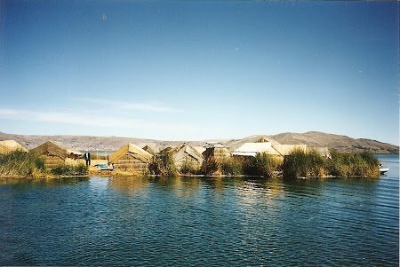
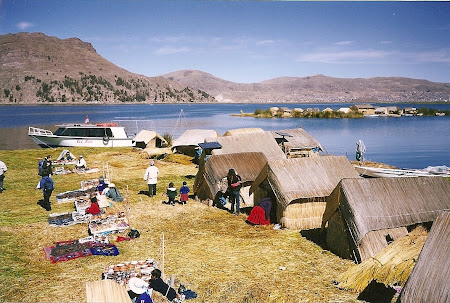
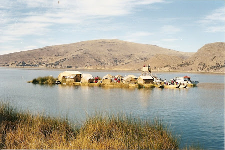
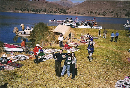
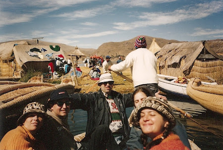
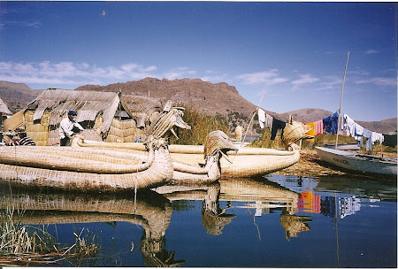
The first stop brings us to a weird, surreal, exotic world…it’s the world of the floating Uros islands. As the tradition says, the natives from this area, the Uros, being threatened by more powerful tribes found shelter on the lake, many centuries ago in order to defend themselves from their enemies, Collas and Aymara, tribes that didn’t know how to build boats. Banished from the ground, the Uros moved on waters and built their islands out of the reed they found in huge amounts on the shores of the lake, settling on the “ground” they had built. Practically, the Uros are weaving their own reed islands. When the reed starts crashing they add one more layer so their own private island continues to exist. Therefore, when you get upset with your neighbors all you have to do is start rowing and move your island a bit further away. Today there are no more pure Uros people, their descendents blended with their former enemies, Aymara and today, only 300 people still live on the artificial reed islands.
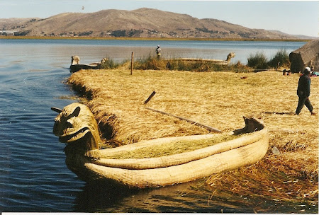
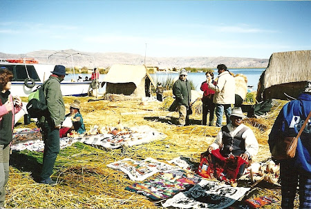
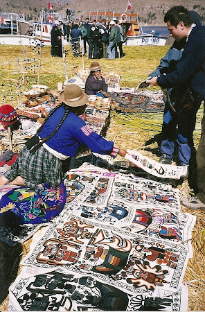
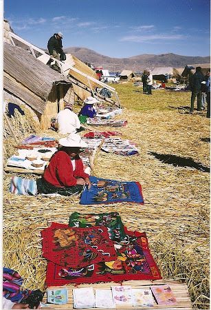
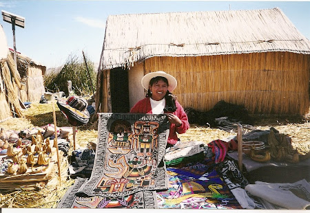
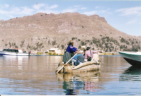
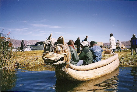
Here we are jumping on the “tourist” island. The first feeling is weird… you’re on solid ground, but you plunge in reed, here and there on the margins water puddles…no problem, the island is generally pretty thick and you won’t get wet. I guess the island we’ve been brought to is the “protocol” island, an island for tourists. On the island there is a tower from where you can take pictures, a Mirador as it’s called around here, natives that sell all kinds of souvenirs, from fabrics picturing Inca gods to small reed boat models. And by the way, the Uros people have boats made out of, obviously, reed, with heads reminiscing of the European dragons. Obviously, everything is commercial – the climbing on the Mirador costs 2 sole (around 50 cents), pictures of the children with the locals some small change, and more than that you can have a tour around the island by boat, most of the boatmen being women. In fact the whole lake seems to be under the sign of the matriarch.
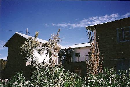
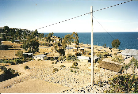
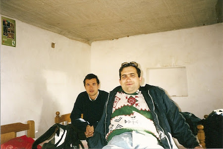
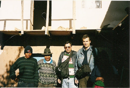
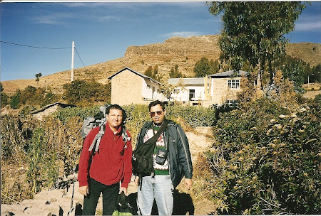
Once pictures are taken, souvenirs are bought and the boat trip completed, we get back to our sailing boat and continue our road towards Amantani Island. Here we will spend the night in the “nice” room of a family house. Life on Amantani is simple and stress free…there are no cars, no electricity, “telenovelas” are unknown, the only things that brings some signs of modernism to a world petrified in a long past century is the tourist armada taking charge of the island. Most of the village people don’t speak Spanish, in “our” family the oldest son, being a bit brighter, mumbles a bit of Cervantes’ language. Otherwise, one can manage around here only in Quechua, the language of the Inca Empire. The house is big and pretty nice looking, clean, we are in the middle of a garden where chickens are running around, in our back yard potatoes are planted… It’s not that different from many villages back home. I used outside backyard toilettes in Romania as well… On the other hand, though it’s sunny, quiet and if you really get bored you can climb the village hill and take a look towards the continent and the sister island Taquile.
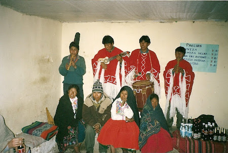
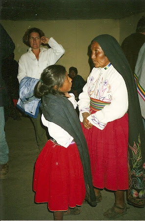
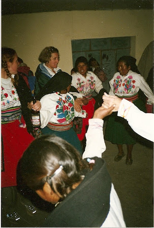
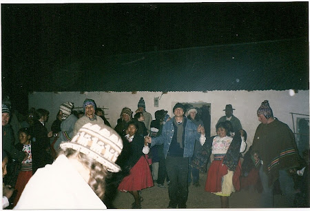
If during day time the people work the fields, at night time though it is fiesta time! Almost everybody on the island, wearing their Sunday clothes, heads out to the community center, where they dance for and with the tourists that come from far away. Two music bands play like crazy, “El Condor Pasa” is requested over and over again… since I arrived in Peru I’ve listened to it a hundred, if not a thousand times, but I still like it. Beer, coke and water, dancing and a good time at the community center or around an anemic fire under the magnificent southern constellations, over 10.000 kilometers away from home, what can be more wonderful…?
Coming home with a flashlight I continue to wonder how the Natives get home without light… and it’s a moonless night. My sleeping bag, may it be healthy, is much more comfortable than the seven Alpaca wool beds offered by the hosts. Although so close to the Equator, at 4000 meters altitude, it is cold. During the day it’s ok, the temperature could even reach 15 – 20 degrees, but once the sun sets, you suddenly feel how waves of cold hit you, lowering the temperature of the atmosphere and it is not uncommon that in approximately 10 minutes the temperatures can easily fall to zero…
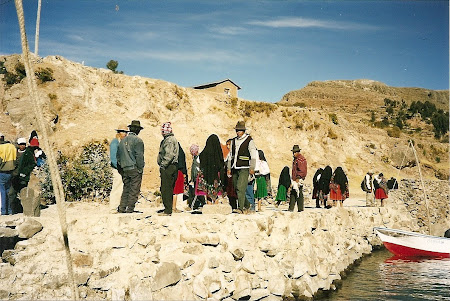
The second morning we’re in front of a feast- omelet from the hen in the garden, potatoes in different forms and ways, coca tea. Muy bien. We say good bye to our hosts and regroup at the docks. We’ll head to the other island, Taquile. Completing our breakfast with some fruits and biscuits we don’t even realize when we arrive at Taquile, the largest island of the Peruvian part.
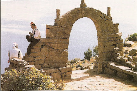
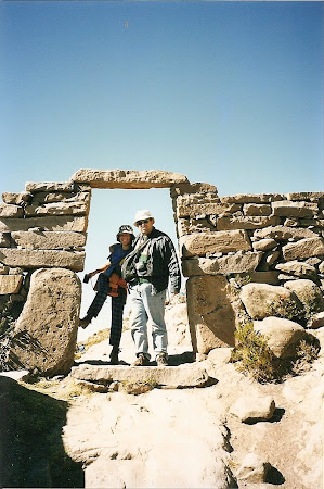
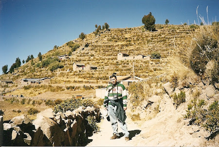
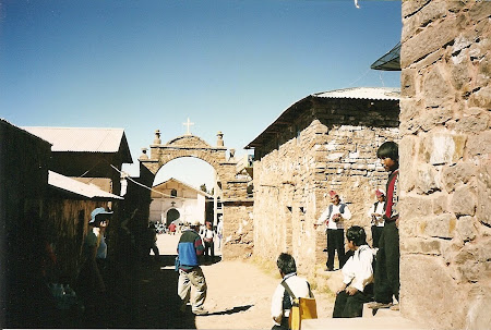
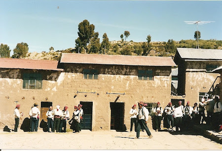
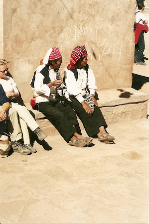
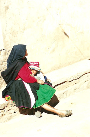
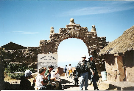
We have to walk some from where the boat leaves us. The roads are paved, the fields are terraced and carefully marked and from time to time we pass through honor gates. Along the alley there are remains from the Inca age and the people don’t seem to have changed their habits a lot, the clothing, their lives. Electricity was implemented a couple of years ago so, at the entrance of the village a big satellite watches over. Yet the village people seem stuck in another time line. The most interesting are the men – dressed in their national costumes, they all wear red hats with tassels. If the tassels lay on the left the man is married, if they’re on the right he’s not married and not interested in getting married and if on the middle, well, girls, maybe you’re in luck – not married, yet interested. And more than that, even if they move around, their major activity is …knitting. Either they’re knitting sweaters and hats for themselves or for tourists, the Taquile people are very funny walking around and talking with their knitting needles in their hands…
After walking on the peaceful island, we go down to the larger dock – Taquile has two harbors and we leave toward Puno… after more than an hour we are back to civilization. If two days ago Puno was this quiet town where nothing was happening, I now wonder of how hectic it is….
How to get there
Not that cheap… Flights from Europe to Latin America cost a lot, but it’s not a bad idea to look over the offer from Iberia… don’t expect though super prices that come up for destination Asia. From North America, you can find from time to time some friendly fares, but you need to watch the offers of South American airlines. From Lima you can take a direct flight to the airport of Titicaca – the airport is in the small town of Juliaca, a few kilometers away from Puno. On ground you have to get the bus to Arequipa (around 10 hours) and then the train to Puno (another 10 hours).
Visas
If you stay less than 90 days you don’t need a visa, just a valid passport.
Altitude problems
Juliaca, Puno and Lake Titicaca are at about 4000 meters. Some might get height sickness, that means a general malaise, nausea, feeling ill, headaches, cold and lack of energy. The first issues can be solved by taking the drug Diamox, but for the lack only adapting to the height will help you.
What to eat
Don’t worry, on the main street in Puno you can find restaurant with very good food at a low price. The special course in Peru is the guinea pig; I was reluctant to eating rats though… The ones that did said it tastes like chicken.
Where to stay
Puno is extremely popular among tourists so you can find numerous hotels or guest houses. On the island one sleeps at the houses of the village people that have a specially set room for gringos. The rooms are Spartan, but clean. In Puno and on the islands as well be prepared for no heating in locations with under 4 stars, so a sleeping bag is vital, along with the lama wool blankets that you’ll find in any room.
Pictures of Titicaca, Peru:
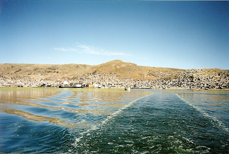
Leaving Puno
Floating village
First steps on the island
Uros Zone
Shopping…
Uros
Antamani island
In our room
With our hosts
Amantani port
Taquile island
on Taquile
Taquile central square
Playing hide and seek







Amazing picture!!
We are audio tour app developers.
After reading your informative post, i really want to develop GPS audio tour guide app for
Titicaca.
Can somebody tell me interesting stops, so that I will create the audio guide app for android and i-phone with
GPS map, audio, detailed text information and high quality images.